
New Insights from Expedition M201
Surprising Volcanic Activity Near Iceland
Underwater Pressure and Volcanic Behavior
Rethinking Volcanic Hazards in Shallow Ocean Zones

Global Digests News delivers timely, credible coverage of world affairs, politics, economy, and technology to keep you informed on today’s top stories.

AI Advances in Flood Forecasting
Google’s open-source AI hydrology framework offers customizable flood forecasting powered by LSTM networks. Validated with Czech data, it b…

EVA-Bench Data 2.0 Expands Enterprise Voice Agent Testing
EVA-Bench Data 2.0 broadens enterprise voice agent evaluation with three new domains—airline customer service, IT service management, and h…

Tech Sovereignty in Europe: Shifting Away from US Solutions
Europe is pushing to reduce dependence on US technology through the European Tech Sovereignty Package. Leading research bodies like France’…

Andreessen Claims AGI Has Arrived, Sparking Industry Debate
Marc Andreessen told Joe Rogan that AGI was reached in early 2026 by models like GPT-5.5 and Gemini 3.0. OpenAI’s Sam Altman remains cautio…
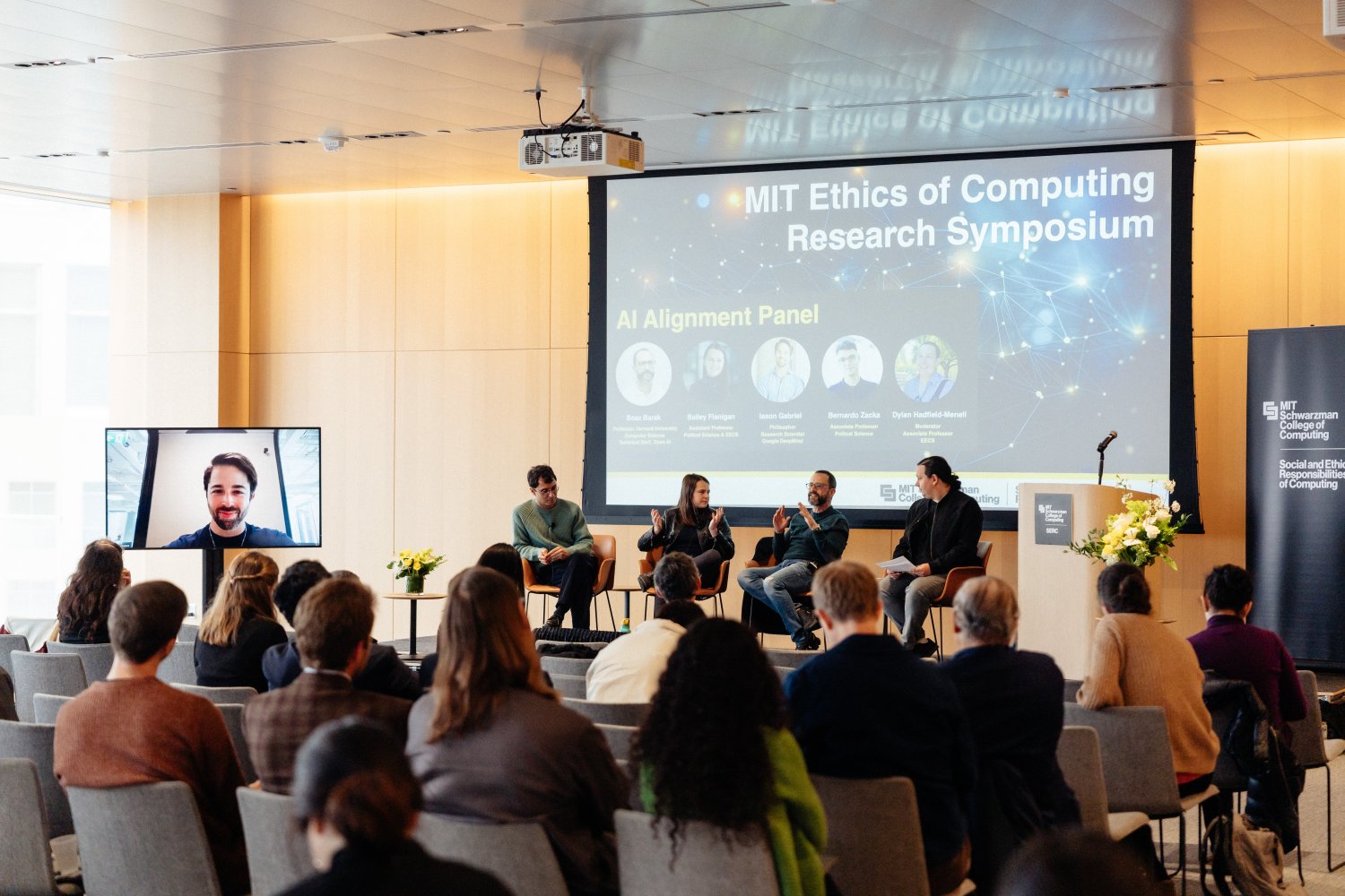
Human Judgment Remains the Linchpin in AI Ethics, MIT Symposium Shows
The MIT Ethics of Computing Research Symposium emphasized that AI can’t navigate ethics alone. Experts highlighted the challenge of alignin…

Early Literacy Gains in Summer: Everyday Moments That Matter
Summer’s unstructured days are fertile ground for early literacy growth. Simple daily interactions—talking, singing, reading signs—build la…

Reid Hoffman Leaves Microsoft Board to Lead AI Drug Discovery Startup Manus
Reid Hoffman steps down from Microsoft’s board after ten years to focus on Manus, an AI-driven drug discovery startup targeting cancer trea…

AI and Fundamental Physics: NSF Renews Support for IAIFI
The National Science Foundation has expanded funding for MIT’s Institute for Artificial Intelligence and Fundamental Interactions, advancin…